In 1986 I was attending the University of Oregon and dating my RA (I know, scandalous!). I had hiked and backpacked and car camped before meeting him, but he was a climber. Climbing had never been on my radar as something I wanted to do, but after listening to him rave about the sport, I took a rock climbing class offered in the UofO’s Outdoor Recreation program and then he and I started going to Skinner’s Butte after class a couple of times a week to climb together. As spring progressed my second year in Eugene, he asked me if I’d be interested in climbing Mt. Hood. I said “YES!!!!!” and at the end of May that year found myself climbing my first Cascade volcano.

I didn’t climb another Cascade volcano for 20+ years (but that’s another whole story about breaking up, moving back to California, and then reuniting with that same guy many years later). Yet, I’ve always held an affection for Mt. Hood and its striking profile … and perhaps some sentimental fondness for my first grand mountain adventure.
Now, with my (relatively) new obsession with long trail runs, I’ve shifted from going UP the volcanos to running AROUND them (including Mt. Rainier in 2018 and Mt. St. Helens in 2015 and 2018). In 2018 Timberline in a day was on my adventure list, but the season ended before I could fit it in, so I shifted it to the top of my list for 2019. Fortunately, it was also on the want-to-do lists of several of my friends.
In the spring we did a bunch of research and read a bunch of trip reports, and made some plans to head down in late July. Last-minute prep included finding a VRBO cabin in Government Camp with enough beds for all of us (score!), and we soon found ourselves traveling south on a Thursday afternoon for a fun Friday adventure. Even better, our friends Kelli, Mike, DeeDee, and Missy would be running the Wy’east Howl 50K/100K the same weekend we planned for our run, so we could cheer for them on Saturday.
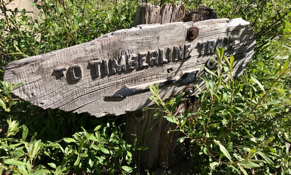
About the trail
The Timberline Trail was built mostly by the Civilian Conservation Corps in the 1930s. The western portion overlaps the PCT (and we met and chatted with several thru-hikers), and the entire trail hovers right around treeline—which means we had lots of views! Distance varies based on which report you’re reading: the Forest Service says 38 miles, 40ish is the rule of thumb, and my Suunto tallied 42. Close enough.
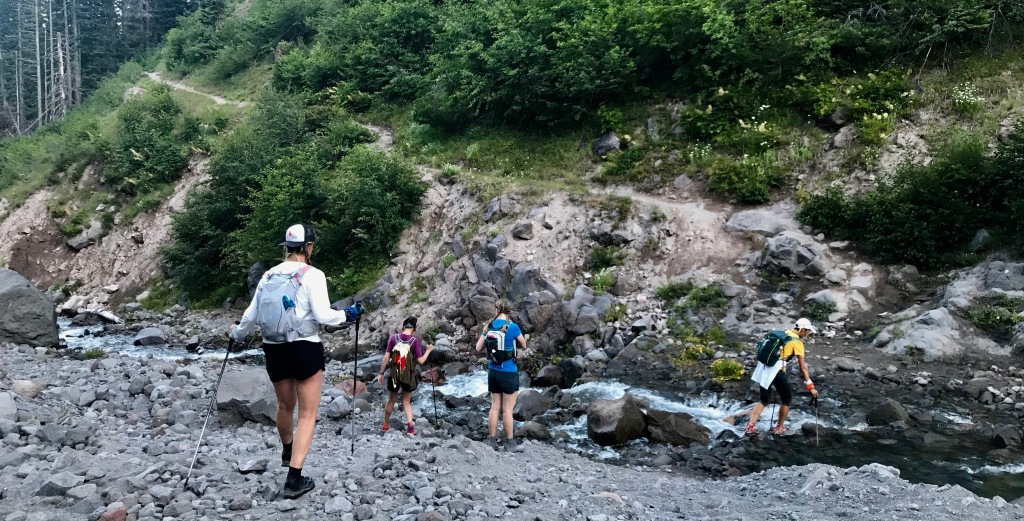
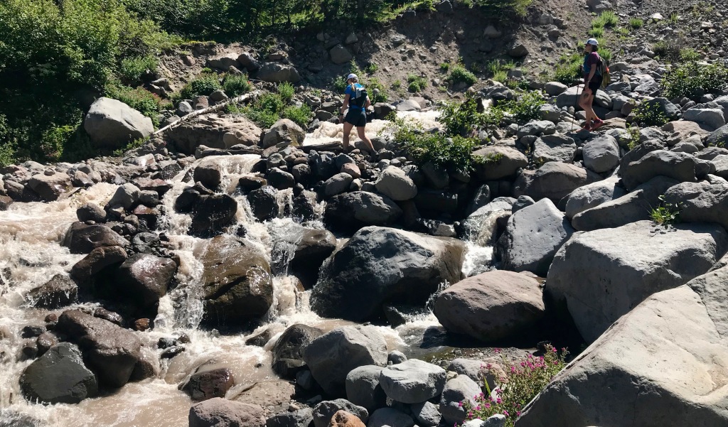
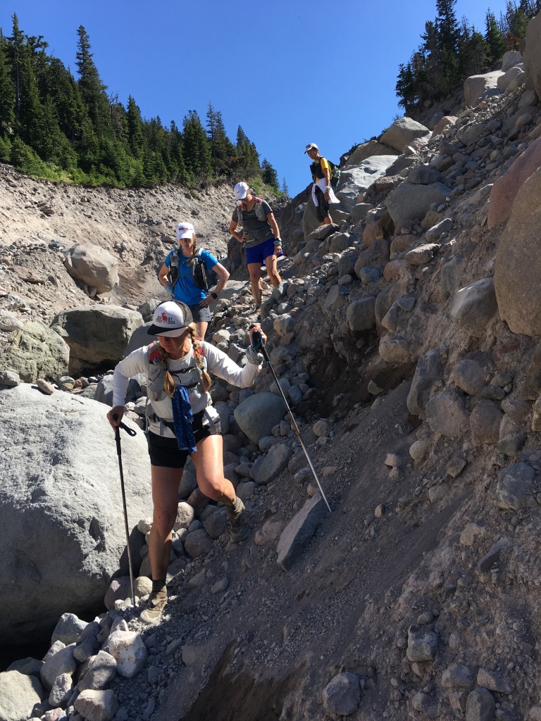
The trail climbs in and out of glacial-fed drainages throughout its length, and with all those ups and downs we ended up with a bit over 9,000 feet gross gain. Each of those “glacier-fed drainages” includes some kind of river or creek crossing, and there are no bridges so they’re all either forded or hopped over using boulders and trees. Because of this, snowmelt levels are an important consideration when planning the timing of your trip.
There’s a lot of discussion online about whether to go clockwise or counterclockwise, and from where to start. We went clockwise, starting at Timberline Lodge. This meant we hit the trail’s high point (at 7,350 feet) at mile 30 and one of the reputedly tougher river crossing toward the end. FWIW, we all later agreed that counterclockwise and starting on the PCT near Ramona Falls would be the best way to go. (Take that advice for what it’s worth: We haven’t done it that way, so what do we know?)


On the trail
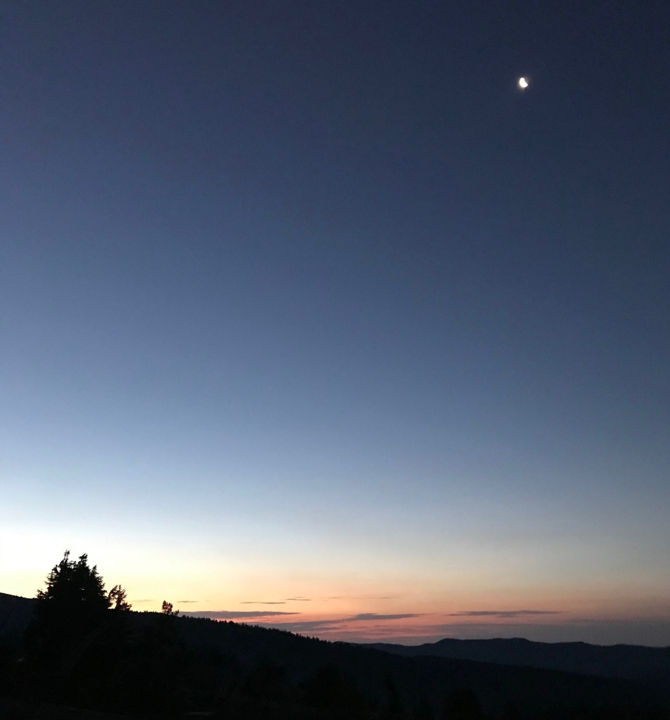
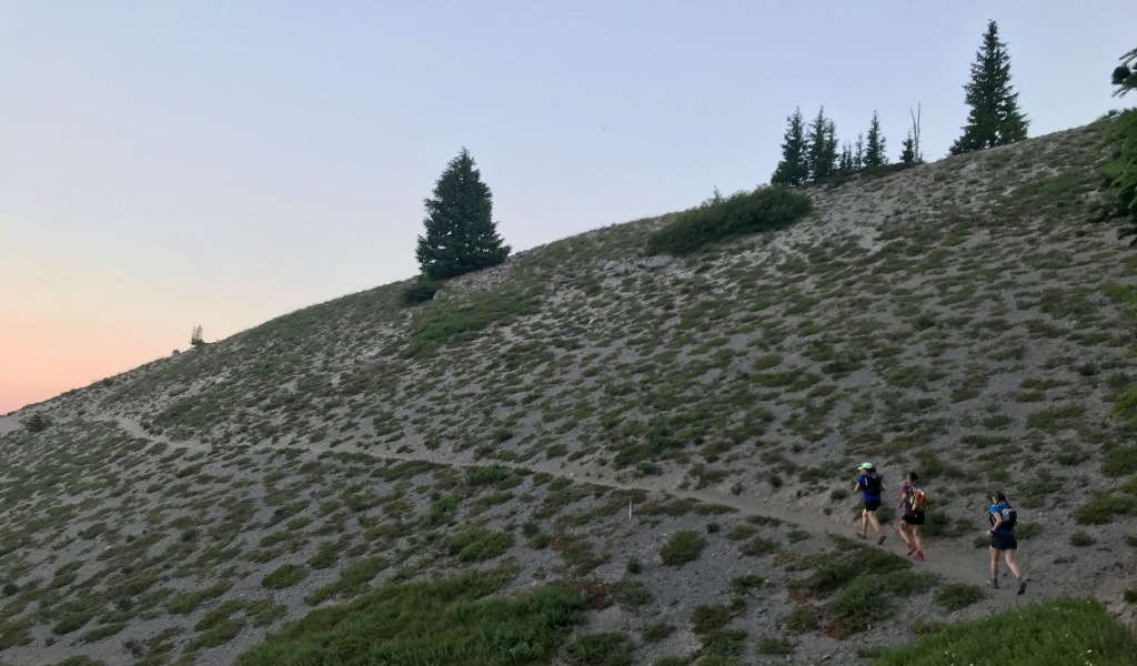
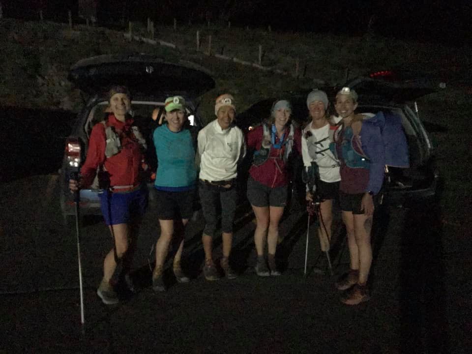
We hit the trail at 5 a.m. The sky was just starting to lighten but we still needed headlamps to see the trail.
As we wound our way west and then gradually northwest, we found ourselves in a sometimes-stark landscape that for me was a bit reminiscent of Mt. St. Helens. We headed down into Zigzag Canyon and our first stream/river crossing, and then worked our way up toward the intersection with Trail 778, which leads to Paradise Park.

Back row: Mt. Hood
We stayed on the PCT/Timberline Trail, skipping the detour through Paradise Park, and soon found ourselves at beautiful Ramona Falls. I don’t have our group photo, but click here for a link to more information and a photo of Ramona Falls. If you’re ever in the area and are looking for a day hike, I think it’s worth your time!
Soon after Ramona Falls, our friend, Kari, caught up to us. She wanted to join the weekend fun, but didn’t want to do the full route. It was fun to have her join us for several miles as we worked our way farther north.

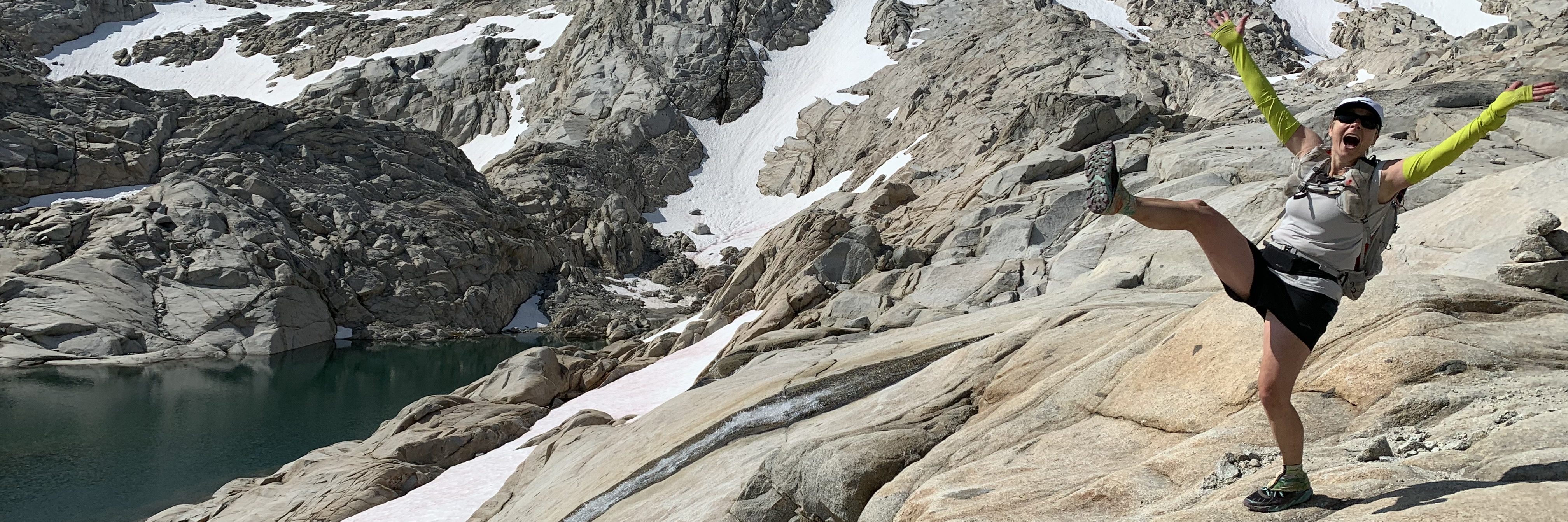
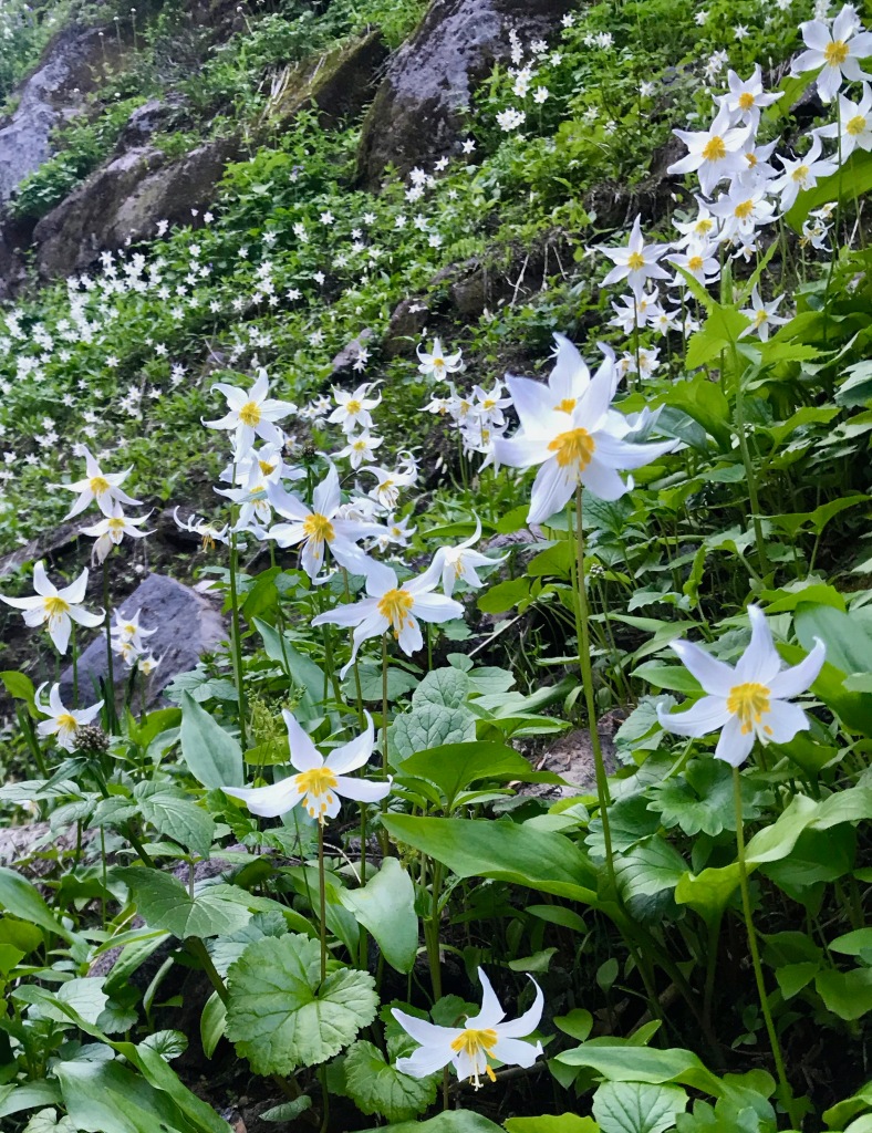
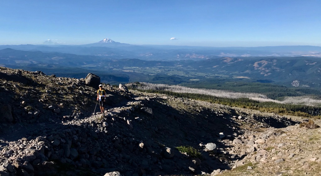
At mile 14+, we hit the far northwestern point of our route and turned east, leaving the PCT behind as we made our way around the north side of Mt. Hood. This was our favorite part of the trip: the wildflowers were insane; at several points, we had views of Mt. St. Helens, Mt. Rainier, Mt. Adams, and out to the deserts of eastern Washington and Oregon in one snapshot; and an old forest fire left acres of dead trees that somehow seemed mystical as they framed Mt. Hood. If you can only do one section of the trail, DO THIS PART!


Of course, there were more river crossings. Some required quick hops and skips to pass, and others involved a bit more planning.
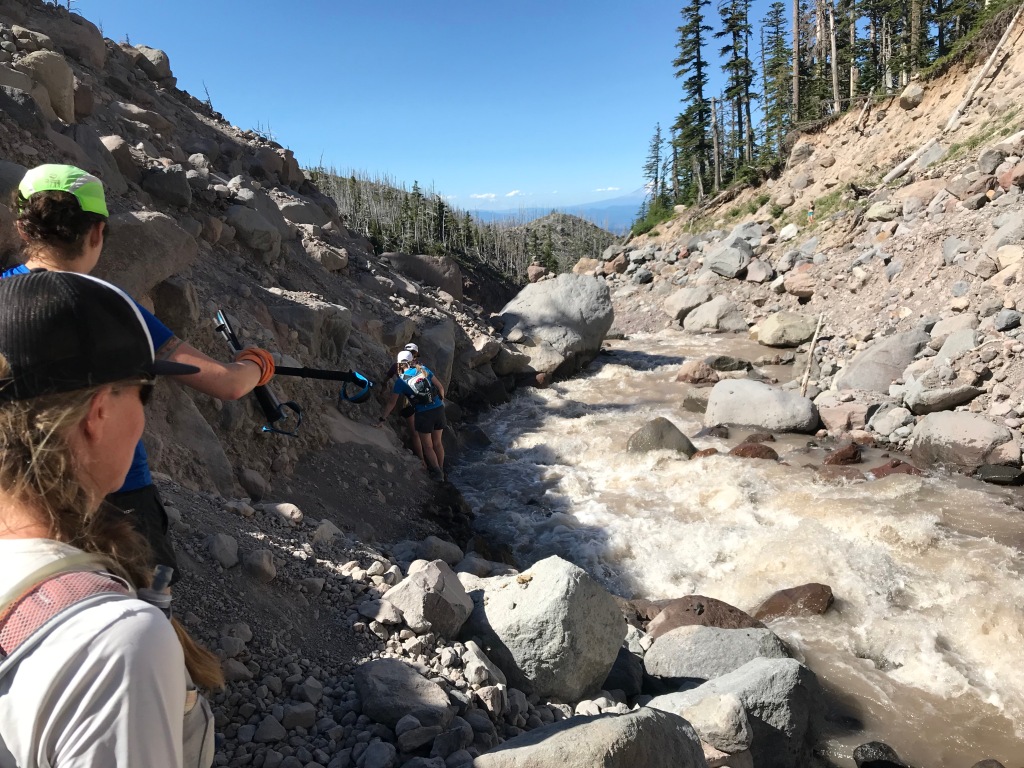
We were soon looking forward to reaching Cloud Cap, where Kari would meet up with us again. This time, she’d have a cooler full of cold Cokes and Snicker bars, both of which were sounding pretty fantastic by then. Our last “hurdle” before Cloud Cap would be to cross the Eliot. This would be one of the highest running streams we would cross on the trail, but fortunately once you get to it, there’s a nice solid tree trunk creating a natural bridge that’s accessed with an easy big step. Getting there is a bit of a slide down loose rock and sand, and a sketchy traverse along the river’s edge.
As we carefully worked our way along the stream, a rock came loose beneath Marna and she was suddenly knee-deep in the water with a death grip on a boulder just above her. Sarah grabbed her arm and working together Marna was quickly out of the water. It was a very strong reminder that things can go wrong whenever you’re out in the mountains.

Once we were across the river, a bit of a scramble got us to a section of rebuilt trail. Look closely, and you can see a serious set of switchbacks going up the hillside.

Kari had been sunning herself on the opposite bank and joined us for the climb up to Cloud Cap. Her cooler of Cokes and Snickers made for a happy “aid station” as we hit mile 25ish. At this point, however, time was slipping by and we were taking longer than we had planned, so we bid Kari farewell and started heading south along the eastern side of Mt. Hood and up toward its high point at 7,350 feet along Gnarl Ridge.
The east side of the mountain was more of a moonscape than any other part. Rocky and barren, with thinning air, it held a different kind of beauty.

At the high point, we stopped to toast each other with a sip of whisky. After a long day and at a bit of altitude, it took my breath away, but added a touch of ceremony to our journey.

Our focus shifted to “let’s get this thing done” and concerns about hitting our final river crossing—The White River—in the dark. As we headed down from Lamberson Spur toward Newton Creek, we encountered several long patches of snow. Ana slipped and self-arrested with a trekking pole, but otherwise the section was uneventful and we maintained our “beat feet” focus.
Ultimately we ran out of day, and our headlamps were dug out of our packs. We kept consulting maps and calculating distance remaining, but for a while it seemed that no matter how much time passed, we were continuously five to seven miles from finishing.

Finally we spied the ski lifts at Mt. Hood Meadows (where Saturday’s Wy’east Howl would start and finish) and we saw trail flagging for the race. We joked about being glad we were going to finish before the next day’s racers were starting, and then again recalculated how much farther we had to go. I think we came up with five to seven miles again, but I’m not sure how much of that was because our calculations had become a farce even to us.
In our minds, our last hurdle would be the White River crossing, and then we’d have smooth sailing back to Timberline Lodge. The crossing itself was unnerving, as we couldn’t see much in the darkness. Vivian plowed right through it, but the rest of us felt iffy and decided to err on the side of caution by joining arms and crossing together. It ended up not being too bad, with the water up to our knees perhaps, but better safe than sorry, especially when you’re tired and not sure what you’re up against.
And then … well, and then we discovered our last two-ish miles would be on sand. Never-ending sand. And cruelly, the trail, which reconnects with the PCT just past White River, heads straight toward the lights of Timberline Lodge and then abruptly veers north, toward the mountain and away from the lodge. I had NOTHING kind to say about it until I later realized that it was noodling along the edge of a big ravine, and therefore it made sense to do what it was doing. As we finally approached the parking lot, a headlamp flashed at us and Kari called out, “Woot woot!” and once again became a very bright ray of sunshine bookending our adventure.
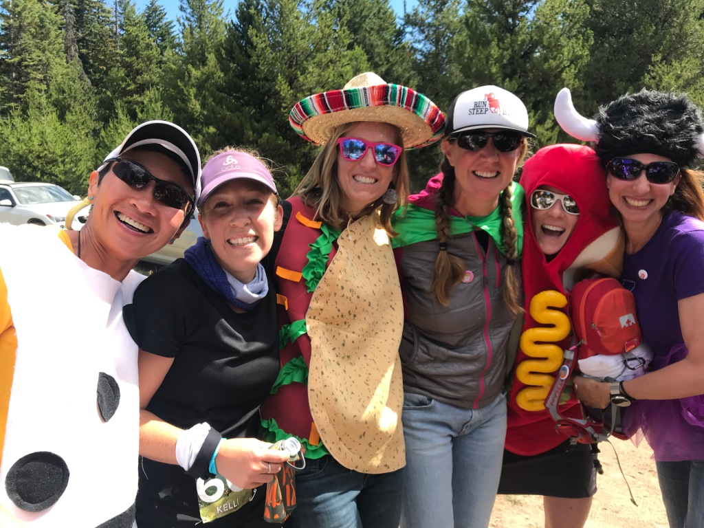
The racers
The next day we got up and drove out to the Wy’east Howl race course to cheer on our friends. Mimosas and costumes, along with a vicious game of Battleship, while lounging around in a meadow were a fine contrast to the prior day and afforded us time to digest and celebrate our friendships and to offer “Woot woot”s to Kelli and Mike, who we saw on course.
Reflection
As I look back on the day on the Timberline Trail and subsequent day cheering racers, I think my biggest takeaway is depth. It takes a depth of training and experience to push yourself, to reach into one’s own internal depths for both physical and mental strength, in the outdoors. These experiences also deepen our friendships: as we’ve reached deep individually, we’ve all gotten to know one another—our strengths, our weaknesses, our moods, what to say when someone needs a kick in the behind—and have supported and been supported by each other. While I still enjoy a long solo day on the trails, the shared journeys hold more texture, more intensity, because of this.
The trail itself holds a special place in my heart because Mt. Hood was where Mike and I had our first big mountain adventure together. That aside, it’s simply beautiful—I can’t think of any part that I didn’t enjoy (except maybe the sand at the end).
All text copyright me. All photos belong to Sarah Brouwer, Marna Kaegele, Ana Hinz, Heidi Flora, or me.

What a great adventure!
LikeLiked by 1 person