
At the beginning of 2019 a bunch of my partners-in-crime got together to brainstorm adventures for the coming year. One that stuck was to do the UltraPedestrian Wilderness Challenge Olympic Coast route. As described on UltraSignup, “This [approximately 58-mile] route runs point to point between the Shi Shi Beach Trailhead in the north, and the Oil City Trailhead in the south. The Olympic Coast Route will test your logistical skills, as it involves timing tides, difficult creek and river fords, and nine miles of road to access the bridge across the unfordable Quillayute River. The Olympic Coast Route may be completed North to South, South to North, or as an out-and-back for the Epic Double.”
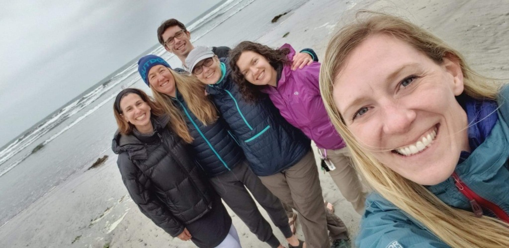
Heidi, Marna, and Sarah were committed immediately to the adventure, Ana was a maybe, and I waffled for a couple of months before formally jumping onboard a few weeks before the trip. After pouring over maps, tide charts, and other runners’ Gaia tracks, we set the date for mid-June.

The Route
“Olympic National Park protects over 73 miles of the some of the most primitive natural coastline in the 48 contiguous United States. The views of ocean, cliffs, headlands, islands and seastacks, coupled with the dramatic changing sea, provide a unique wilderness experience. Most of the coast can only be accessed by foot.”
(National Park Service)
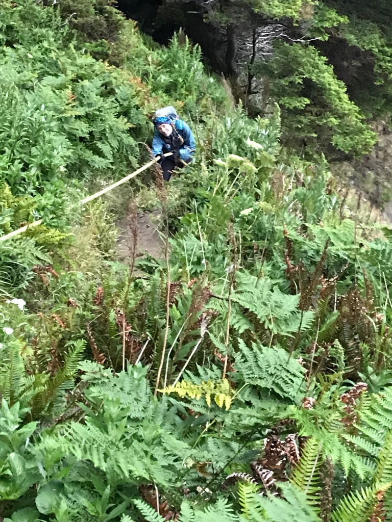
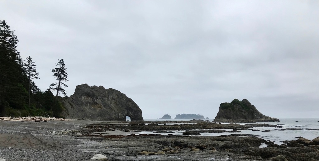
The route itself covers about 48 of those 73 miles, using the shore and, in several places, overland routes accessed by ropes and dirt scrambles. Ten additional miles are road miles that are required to get from Rialto Beach to Third Beach, which are separated by the unfordable Quillayute River. In the National Park Service map below, you can see the trail to Shi Shi Beach starting in the Makah Indian Reservation and at the bottom the Oil City trailhead, just north of the Hoh Indian Reservation. An X represents an impassable headland (where the overland routes have been built) and an orange • represents areas where a low tide is required to pass.

LOGISTICS
One challenge with a point-to-point route is the shuttle. The drive from Seattle to Shi Shi Beach, where we decided to start, is a half-day on its own. Add three hours each way on a two-lane highway to get from Shi Shi to Oil City and back, and you’ve got a REALLY long day of driving before a hard trip. In addition, there is very little parking at Shi Shi (although there is a local resident who offers parking space on her property for a minimal fee). We lucked out as friends offered to help with the shuttle: a huge shout-out to Wendy and Kari, who drove out to give us some pre-adventure cheer and support before heading to their own adventure on one of the San Juan islands, and to Ana (who ultimately decided this wouldn’t be her adventure after all) and Adam, who ended up doing tons of driving to make it all work.
We camped the night before at Hobuck Beach Resort. They don’t take reservations but have 300 spots available. We had a wide selection to choose from! At the campground office, we were also able to purchase our permit for using the tribal lands we would be passing through at various points during the trip.
With our schedule driven by the tides, we would start at 2 a.m. at Shi Shi Beach trailhead. This gave us some buffer time wise to allow us to make it past several key points that are impassable at higher tides, and would also get us to Rialto Beach and the 10ish-mile road section in the daylight. After regaining the coast at Third Beach at mile 41, we would then have 17 miles and two tide-critical passings to traverse before reaching the Oil City trailhead.
As we have done on other crew-supported trips, we carried a Garmin InReach with us and Adam and Ana carried a second. This would enable us to call SOS if needed. In terms of logistics, having the two InReach devices allowed us to communicate with Ana and Adam via device-to-device texting—super handy for when for keeping our crew updated on our progress with no cell service available.
Also as we have for past trips, we shared a multi-tab google sheet with route details and beta, tide charts, food and gear lists, etc. For this route, our route details included landmarks and distances, tide levels required for safe passages around specific points, and clean water sources. The ongoing irony with anything ocean-related is the abundance of water and the lack of drinking water!
I’ve never had a harder time figuring out where i was
We were pretty much on time with heading out, and we covered the two miles out to the beach quickly. And I quickly found running along the sand in the dark terribly disorienting: I could hear waves, but couldn’t see them despite my headlamp, and I didn’t have any sense of where I was going, how much progress I was making, or where landmarks were.

My inability to get a sense of where I was continued even after daybreak. There were some obvious landmarks—such as fording the Ozette River and the overland sections—but everything else just seemed like a treadmill with the same scenery going by. I am certain I drove everyone else crazy with my continual questions: Where are we now? What’s our next landmark? Where did you say we’re going next? Despite having my own trip outline in hand, Gaia running on my phone, and paper maps, I just never got it. It was the weirdest thing.
A result of my lack of orientation is it’s very hard to write this trip report. I usually follow the progression of the adventure when I write, but all I have is a start, an end, and in the middle, a collection of snapshots of feelings, experiences, and views.
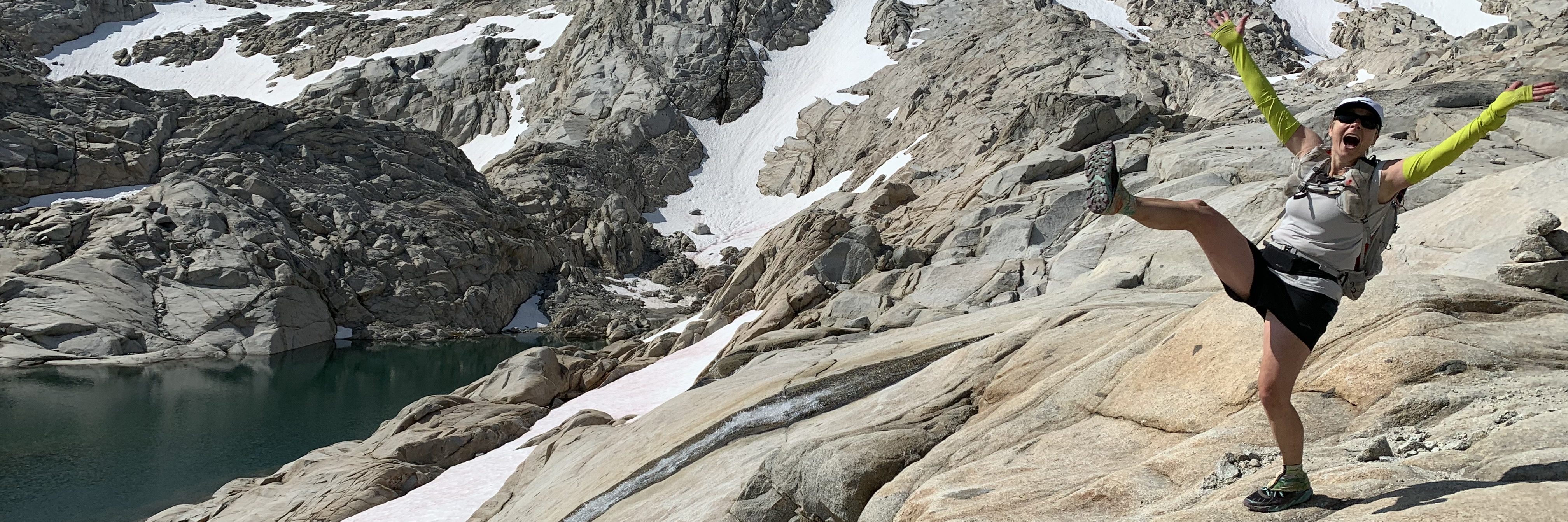
The middle: magic on the coast (with a dose of reality)
The Olympic Coast is really remote and wild—something that is hard to come by nowadays. I saw more wildlife between Shi Shi and Rialto than just about anywhere I’ve been. We watched a sea otter floating on its back and then diving and playing in shallow pools near the shore. We saw so. many. bald. eagles! plus a million other sea birds. Of course, we saw raccoons (notorious food thieves that campers must beware)—especially at night, when their eyes glowed like little heathens in the light of our headlamps. One of our favorite things was that we followed the footprints of a small animal (raccoon?) and a coyote literally for 15 miles down the beach! We never saw them, but we invented a delightful story of two friends also out on an adventure walking south along the coast together.


The sea life—especially in the tide pools—was crazy. So many little creatures in a grand landscape.


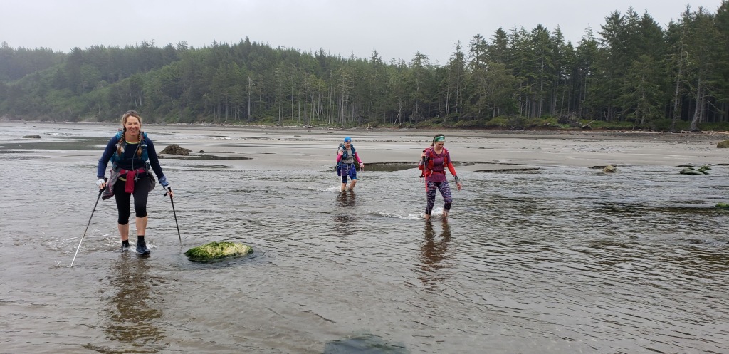
The terrain was a mix of sandy beaches, little rocks, big rocks, wet rocks, rocks covered with seaweed. It was really mentally draining, because at no point could we just walk or run. Full-time attention on where we placed our feet was imperative. We also had to scope out routes as the tide came in and find our way over/under/through different rock formations. It was much tougher and slower going than just about anything I’ve ever done.

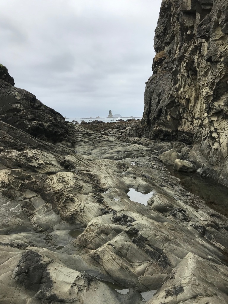

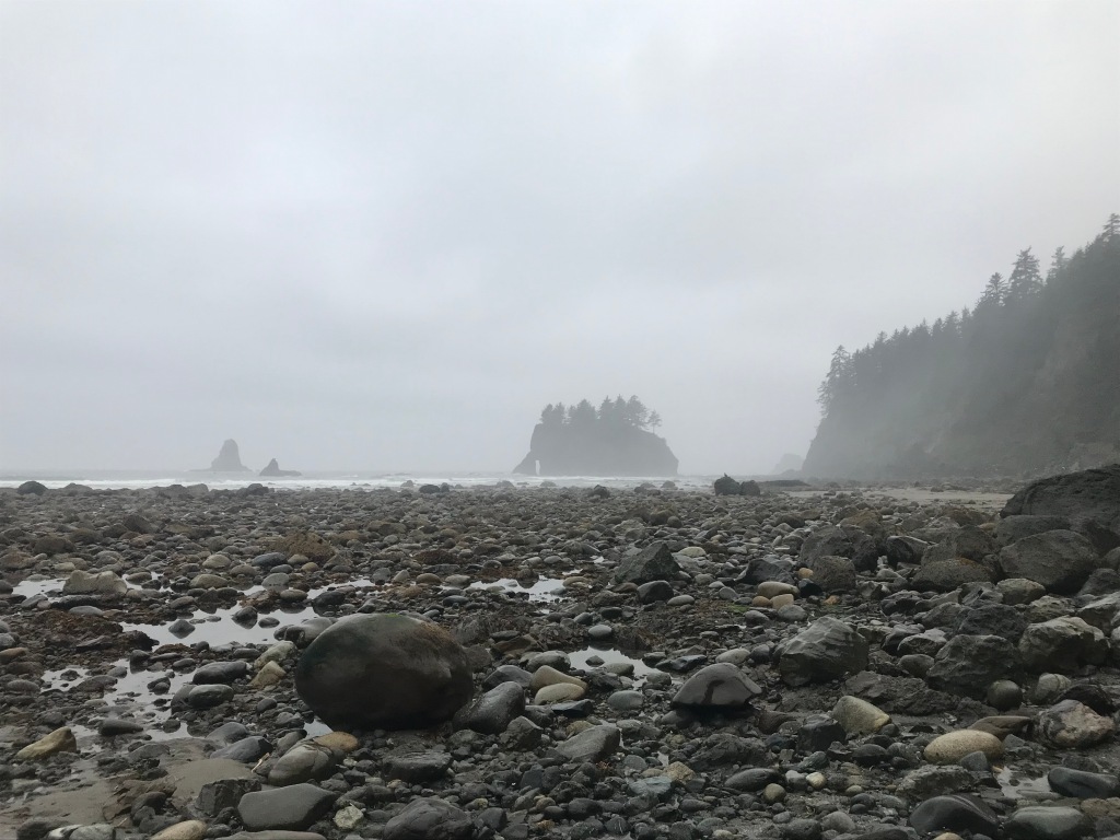
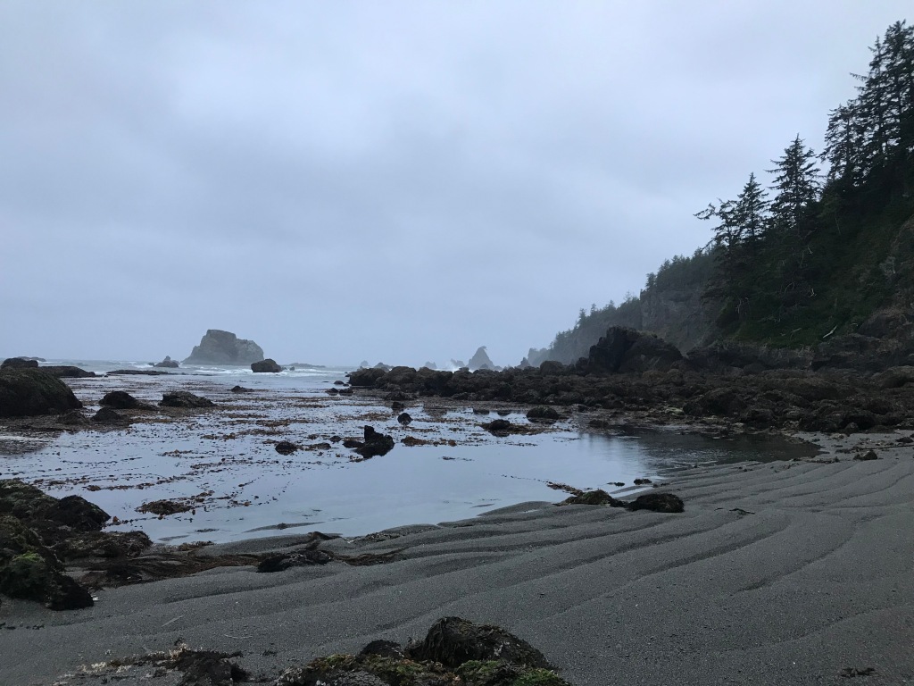
Despite the rough going, it was beautiful. Like breathtakingly beautiful. The sea stack formations, the rock carved by thousands of years of waves, the forested land coming up to the high tide line. The scope is difficult to take in.


In contrast to all this wild beauty, on many beaches we saw evidence of the human impact on our oceans. Some areas were blanketed in styrofoam, nets, floats, plastic bottles. For a time, a large shipping vessel motored its way up the coast. We could barely make it out on the horizon, but we could hear it and even feel the vibration of its engines throughout our bodies for a long time: it gave us a little window of insight into the impact “our noise” must have on sea animals, especially those who use sound to navigate, communicate, and hunt.
The end

I ended up texting Ana and requesting a pick up at Rialto (mile 34ish), while Heidi, Marna, and Sarah continued on and in true warrior fashion, finished the damn route.
There are a multitude of reasons, all of which are my fault/rest on me. I think they mostly stem from my waffling about whether to go: I don’t think I was emotionally fully committed to the journey, so things I could have overcome instead became huge barriers to my continuing. In addition, my planning wasn’t as complete so I (1) hadn’t internalized the route and felt overwhelmed by what was yet to come on an ongoing basis and (2) made critical packing errors. Some are lessons learned (maybe all of them?), so I’ll share them here:
- Sarah kept saying it would be cold on the coast, but the forecast was for a nice weekend. In the end, it was misty and chilly the whole weekend, and I was underdressed. Bring the right layers!
- The challenges related to clothes were amplified by my body alternating between being overheated when we were scrambling over rocks or headlands and being cold when we were on sand. Bring the right layers!
- By the time I got to Rialto, I was dehydrated. I didn’t appreciate how hard it’d be to get clean water, and I couldn’t get myself to drink marsh-stained water even after filtering it. It smelled like a peat bog, it looked like tea, and that messed with me. We also wasted a lot of time following streams inland, looking for clearer water, when it simply wasn’t going to happen. Plan hydration better!
- My feet! Once my feet were wet, they stayed wet, and then they gradually got sandy too. I ended up very close to a serious case of trench foot, which I found really painful. Bring more socks! I had a spare pair, but in reality, I’m not sure what I could have done about this. I suspect I needed to suck it up and be stronger mentally.
- Group pacing. I am comfortable with scrambling on rocks, and there are sections of the route where you are jumping rock to rock or climbing up and down or over and under boulders for long periods. I would clamber along, and then spend time sitting, waiting for the others. Conversely, there were times where the others were waiting for me as they trotted along sandy beaches and I huffed and puffed and whined about my feet.
- Food. No, seriously, this was a duh! moment. I forgot one of my two food bags in the car when we headed out. I got really worried about having enough food for the length of time we’d be out there.
Reflection
I remain humbled by this place where I get to live, by the challenges and opportunities I am given in the outdoors, and by the friendships I share with some really amazing, giving, and strong people. I am in awe of Heidi, Marna, and Sarah for completing the journey, but also just in general because they’re amazing accomplished people who are incredibly strong physically and mentally. I’m glad I shared a large portion of the journey, and—they’ll get this—while I am sad I didn’t complete the full journey, I’m still not sorry I was sitting in a Mexican restaurant stuffing my face with chips and salsa while they continued on. For me on that day, it was the right decision.


Big dose of reality! It looks like a romp, but I can imagine how wearying a route like that would be.
LikeLike
It was tough … but truly beautiful!
LikeLike
Great write-up, Ellen. Love the photos and the self-reflection at the end. This is one of those routes that I’ve read about enough to know it will likely forever remain in the “Nope” column for me. 34 miles and a bowl of chips sounds like a hell of an accomplishment.
LikeLike
Thanks Doug! I keep going back in my mind and wondering whether I want to go back and finish what I started, but I just don’t know. I definitely think getting out there and doing portions is worth it: it’s so beautiful and wild.
LikeLiked by 1 person
Excellent report. I liked that you stopped to observe and absorb the natural world while on this challenge. Your lessons learned will be useful to me, I hope to fast pack this route in 2020. My pace will be about that of a snail race!
LikeLike
Thank you! Have a great time when you go! Can’t wait to hear about it.
LikeLike