Back in May my friend, Kelly, reached out to a bunch of us to see if we were interested in fastpacking the Copper Ridge Loop in August. It is well known that I have a bad case of yes-itis, so of course I said “yes!” At the time, I didn’t realize this would end up being two weeks after the Wonderland Trail and one day after my family and I returned from California for my dad’s funeral and two days at Disneyland for the girls’ birthday. So it was kind of crazy and I ended up tearing the house apart the night before heading out trying to pack and stay light and find gear that I hadn’t used in a while.
We met at a local park & ride, stowed everything in Kelly’s car, and headed north to Glacier to get our wilderness permit. Then off to the trailhead we went!
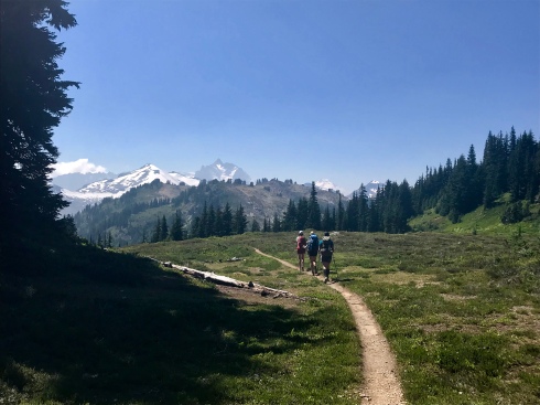
We had decided to do the loop counterclockwise, starting at the Hannegan Pass trailhead and camping at Indian Creek (approximately 14 miles) and then completing the loop (approximately 20 miles) on day 2. This worked out well for us; while it gave us a bigger climb up to Copper Ridge than the clockwise loop, we closed out the trip with amazing mountain views (which you don’t get in the valley along the Chilliwack River).

The Puget Sound region has been plagued by smoke from wildfires burning across the West. The day before we headed out, camps and outdoor sports were being canceled because the air quality was hazardous. Day 1 was still pretty smoky and hazy, but the forecast for the next day was better so we had our fingers crossed.
We started the 4ish-mile climb along Ruth Creek, up to Hannegan Pass. The air quality wasn’t great, and when the trail passed through open sections we didn’t have very good views. We did pass a large work crew from Washington Trails Association doing trail work along this stretch. We thanked all of them—trail work is hard physical labor, and they’re all volunteers.
Once we reached Hannegan Pass, we had a quick mile downhill before we would take a right turn onto the Hannegan Whatcom Trail. (To the left is the Copper Ridge Trail, which we would descend the next day.)
From the turnoff, our next section was about 5-1/2 mostly downhill miles through a mix of forest, overgrown bushes, a million blueberry bushes (trail snacks!), and a longish section where it looked like a trail crew had taken a weed whacker to the brush (which we appreciated). I really enjoyed the small creeks along here: several had these fantastic rock pools that looked like they’d be great for swimming in if we’d had the time. However, there really weren’t any views along this section: just a lot of trees, bushes, plants, etc. We gradually made our way closer to the river, and finally arrived at one of the highlights of the trip—the cablecar!
At this time of year, the Chilliwack looks pretty easy to ford, but how could we resist the novelty of a human-powered cablecar river crossing in the middle of a national park? On the north side of the river (where we were), we ascended a ladder up to a wood platform. The car rides along a cable that stretches from the platform to another one on the other side. The cablecar was on the other side of the river, so I pulled the rope which brought the car to us. My friends teased me about my addiction to the battle ropes course I’ve been going to for a couple of years now and how I managed to find a way to mix in ropes wherever I go. Ha! Anyway, Heidi and I hopped in the car, and with some whoops and hollers and sightseeing along the way, crossed to the other platform. Marna and Kelly went next, and they did some whooping and hollering too.


From there, we had some ups and downs for another several miles. A couple of my favorite parts of the trail were the view of the river from a bridge and a sign notifying us we were 9.1 miles from the “international boundary.”


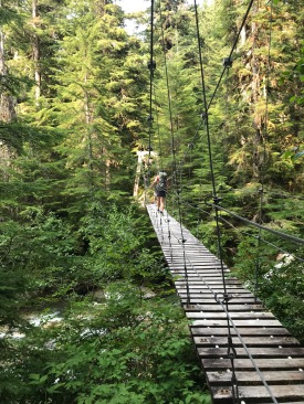
We then met up with “Galloping Gertie.” This suspension bridge, which you encounter just before Indian Creek Campground (where we were planning to camp), bounces and twists as you cross it. Yeehaw!
After the bridge, it was a quick walk into camp. We found one other party—a trio of men, probably in their 60s—who pointed out the trail to the toilet and to the two other campsites. We chose the one farthest away and set up camp. We started out with a mini happy hour feast, then turned to freeze dried meals with whisky and chocolate for dessert. By then it was all of maybe 5 o’clock, which meant a long wait for it to be dark enough to sleep. We entertained ourselves merrily trying to hang our food, as none of us could get a good toss to get our rope over our designated tree branch. Too low, too right, too left, and the rock falling off the end before the rope really got anywhere. It was hysterical. To our chagrin—and relief—one of the men from the other campsite came along and tossed our rope for us. But that ended up being kind of funny too. Then we headed back to camp to wait, and wait, and wait for darkness.


The next morning we were on the trail by 6:30. We had 1 mile to go to reach a ford of Indian Creek and the Chilliwack River. The men from the campground had already made it across and pointed out a way to get across without the water going over our boot tops. We all looked down at our trail runners, shrugged our shoulders, and tromped through the water. It was definitely a “good morning, wake up!” cold crossing, but expedient.
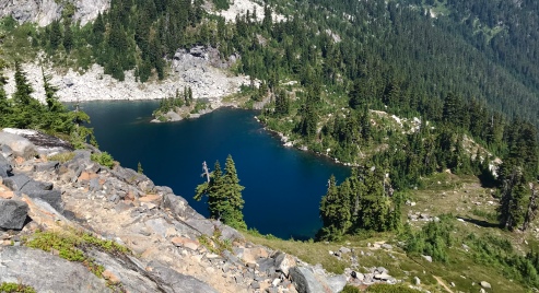
After the water crossing, it’s a long 7.5 miles and 3500-ish feet of up to Copper Lake. We passed through forest for much of this stretch, occasionally seeing small streams and flowers, and then back into the forest. After a while, we started gaining the ridge and could see down to the river. It’s always rewarding to see where you’ve come from!


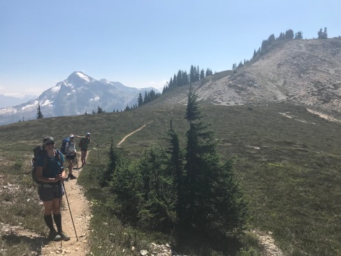
Once we gained the ridge, we still had more climbing on our way to Copper Lake. Now we were out in the open and views of Mineral Mountain, Easy Peak, Whatcom Peak, Luna Peak, Mt. Fury, and many others would appear as we exited the forest and rounded corners. This was a wonderful stretch that sometimes reminded me of the High Sierras with granite blocks and open views.


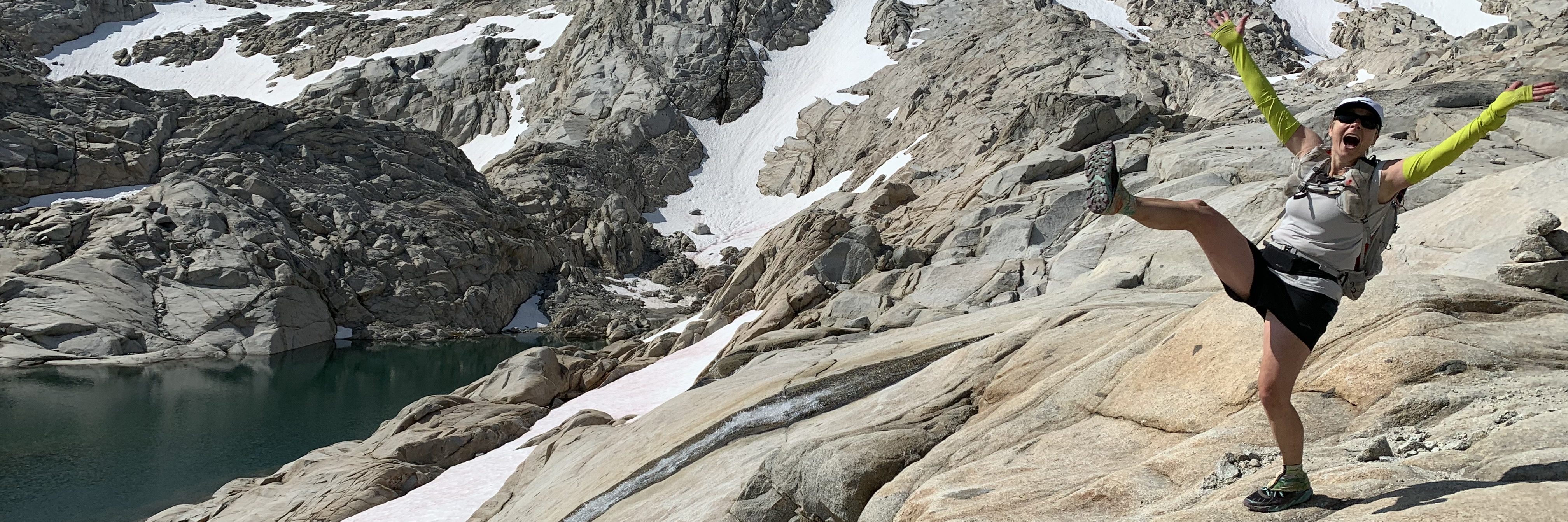
It was near the section you see above, in the bottom left photo, that I was distracted by the views and lost my footing. My left foot slid off the loose gravel and as my weight shifted with it, the rest of me followed. I was later told that I called out a very calm, “Um…guys,” but otherwise simply fell in slow motion. Once I stopped, my right foot, ankle, and knee were hollering a bit and I sat there taking stock. Fortunately, after a minute or so, I was able to get up and continue on, but my foot hurt more and more on the day went on. Nothing to do but keep going, so I did; Advil did become my friend.


At Copper Lake we stopped to enjoy the blue water (I was reminded of Lake Tahoe) and refill our water for the next long climb. I wandered over to the campground to find the toilet, and got a kick out of the high-tech composting toilet that made me think of some kind of Mars Rover. However, when you’re sitting on it, the views are fantastic!


From Copper Lake it is another 1.3 miles up to Copper Ridge Fire Lookout (at our high point of 6250 feet). I didn’t mind the climbing, as I was well distracted by the views all around. There were two other women already there, and just as we were nearing the top two pieces of foil from their lunch were caught by a breeze and went flying into the air. As they (and we) looked on helplessly, the thermals took the foil higher and higher. Suddenly one dropped about 20 feet behind me and I made a dash to grab it before it took off again. The other was last seen drifting high above the Chilliwack River, possibly headed toward Mt. Challenger. If you encounter it, please know that the person who lost it was very upset about littering in the wilderness.

From the lookout, it was “all downhill” until we would meet back up with the start of the Hannegan Whatcom Trail and turn back to begin retracing our steps over Hannegan Pass and back to the car. Of course, all downhill means that yes, you will lose nearly 2000 feet of elevation but you’ll do it by going up and down and up and down the whole way. Since we had Mt. Baker and Mt. Shuksan towering in front of us the whole way, we thought that was just fine.


As we reentered the forest, we started to shift into “get ‘er done” mode. The packs—much heavier than we’re used to—were fast becoming mortal enemies, my foot was throbbing and had me walking funny, which was giving me unfamiliar blisters on my other foot, and we had lost the reward of the wide-open views we had just enjoyed. It was here that we encountered more people than anywhere else during the trip. Some were backpackers, some had done some cross-country treks, and others were climbers heading out or returning with heavy packs with ropes, ice axes, and helmets.
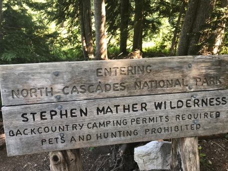
We continued on, rarely stopping and with less chatter, and suddenly found ourselves back at the intersection with the Hannegan Whatcom Trail. This marked our departure from the North Cascades National Park and the start of the mile climb back up to Hannegan Pass. We all felt like it had been a week, rather than a day, since we had traversed this bit of trail. Weird how trail time and “real time”—whatever that is!—can be so different!
The final 4-1/2 miles seemed to take forever and no time at all at the same time (clearly I was getting goofy). At the cars we cheerfully took off our packs and threw them on the ground. After a quick change of clothes, we headed down to Ruth Creek to soak our feet and enjoy a cool drink. It was the coldest darn water and a great way to end the day!

Perspective
After completing the Wonderland Trail, I was pretty burnt out. I took a full two weeks off and didn’t do anything—no gym, no walks, no hikes, no runs—except for the 8 miles a day I walked at Disneyland. When I started out on the Copper Ridge Loop, I had what I called my Wonderland Trail Adventure Hangover. My body felt fine, but my mind was struggling to be “into it.”
The cool thing was that once we got going, and once we hit that cablecar crossing, the switch got flipped. It was fun to be out again, and Heidi, Kelly, and Marna were great adventure buddies. I loved the views of day 2 and felt like I was back in my happy space.
I wasn’t sure that getting back out would be the answer to my adventure hangover. I was thinking about shifting to road running for a while, taking a break from the trees and trails, in order to refresh my mind. Who knew that going right back out there was the answer? I’m very glad it was.
The other big thing this trip reminded me of is how quickly you can get hurt out of nowhere, when you least expect it. I’ve had several friends take simple spills on the trails over the past couple of years and end up with broken or severely sprained ankles. As I worked my way through the final miles yesterday, I despaired that my fall race plans were in jeopardy and I was mad at myself for that moment of inattention. I feel very lucky that all I have today is a bruised and tender foot and a tender knee. I should be fine in a week or so.
I’m so glad I have awesome friends who like to instigate adventures!


This looks like such an amazing adventure. Wow, what scenery. ❤ (I so miss running by wildflowers with you!) I'm glad that the run plus those amazing ladies pulled you out of your (totally understandable) adventure hangover. You really have been doing it all this year! I really hope your leg is improving, so it's ready for more awesomeness. Thanks for sharing!!
LikeLike
We totally toasted you with that whisky!
LikeLike